Transport orchestration for multi-carrier logistics
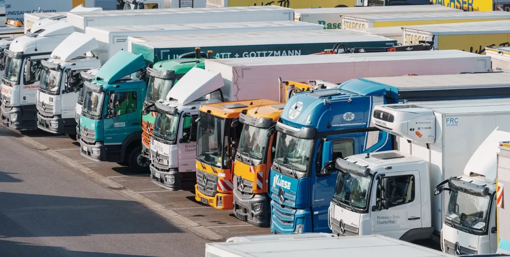
Multi-carrier logistics often breaks down between systems, carriers and networks. Learn how transport orchestration helps teams manage disruptions, align operations and keep deliveries moving in real time.
24/7 Simacan support, no scripts, just real people
24/7 Simacan support, no scripts or chatbots. At Simacan, you speak directly to experts who understand your transport operation, analyse data and solve issues in real time, even in the middle of the night.
The fascinating journey of navigation

The fascinating journey of navigation Navigation determines how we move. Not only at sea, but also on the road, in the air and, today, within smart logistics networks. What started with watching the stars has evolved into a global system that knows our exact location every second. It’s been quite a journey – or as we like to call it ‘a trip‘ – through time to get to the navigation we know today. Navigating by the stars Before technology, there was instinct. And stars. Ancient cultures and navigators, such as the Simacan, were able to travel thousands of kilometres across open seas using the sun, moon, stars, wave patterns and birds. No map, no compass, just knowledge and observation. Even in stories like Homer’s Odyssey, the importance of celestial orientation is clearly visible. Instruments that changed everything The first serious navigation tools emerged around the year 900. The kamal (a simple wooden card and string used to measure latitude) and astrolabe (a brass instrument for calculating the position of stars and the sun) helped sailors determine latitude using the stars. Centuries later, the compass appeared, invented in China and soon adopted by European ships.In the 18th century, the sextant and chronometer changed the rules of the game. Longitude could finally be calculated, making maritime navigation safer and more efficient. In the centuries that followed, nautical charts, dead reckoning, and in the 20th century the gyrocompass and radar were introduced. Each instrument built on the previous one, always with the same goal: more reliable navigation under increasingly complex conditions. Navigation reinvented: the satellite era In 1978, the first GPS satellite was launched into orbit. Since then, navigation has become not only more accurate, but also real-time and global. Today, GPS is woven into everything, from aircraft to bicycle couriers, and from private cars to large-scale logistics operations.But determining a location is one thing. Interpreting a location correctly is something entirely different. Because ‘where is here?’ is not a simple question in logistics. In our blog series on location referencing, we explain why a house number is rarely sufficient, and why an entrance, dock or loading bay makes the real difference.Navigation is no longer just about ‘how do I get there’. It is about what happens along the way, what changes, and how you can adjust in real time. Navigation in transport: the address is only the beginning In transport and logistics, navigation is a different story. A stop, whether for loading or unloading, is not a dot on the map, but an agreement. An expectation. A deadline. And it comes with far more variables than just an address.Yes, you can send a truck to Mainstreet 12, but where exactly should it unload? Is there a rear entrance? Does the vehicle fit through that street? Is the route allowed given emission zones, height restrictions or time windows?Navigation in this sector is not a solo act. It is a dynamic interplay of vehicle characteristics, operational requirements, traffic information and constantly changing plans. An unexpected traffic jam or road closure is not a minor inconvenience, but a potential disruption of an entire chain.That is why navigation in transport must not only be real-time, but also context-aware. It needs to understand which vehicle is driving, what the on-site situation looks like, how loading or unloading can be done safely, and what happens when the plan suddenly changes. Without phone calls and without hassle.Navigation here is not a route. It is an operational foundation. Only when all information is correct, from dock number to arrival time, can deliveries truly be reliable. Julie: a story that begins with the stars Finally, as we have said before, we are proud sponsors of Julie. She brings the ancient story of navigation back to life. Not on a screen, but at sea. Under the starry sky where it all began. Her journey is a lesson in adjusting when things turn out differently, and in trusting what lies ahead, even when you cannot see it yet. This is navigation in its purest form: human, raw and meaningful. A beautiful parallel to what we build every day, technology that helps you stay on course, wherever you are going. https://youtu.be/YLxIH2iPeR0 Navigating the unknown Julie explains everything about her journey and her expectations in this video. Watch her video here. This might also interest you:
AI in your logistics Control Tower: smart move or risky leap?

Discover how Simacan uses AI responsibly in logistics Control Towers. No black boxes, just explainable logic, EU AI Act compliance, and real-time reliability for your supply chain.
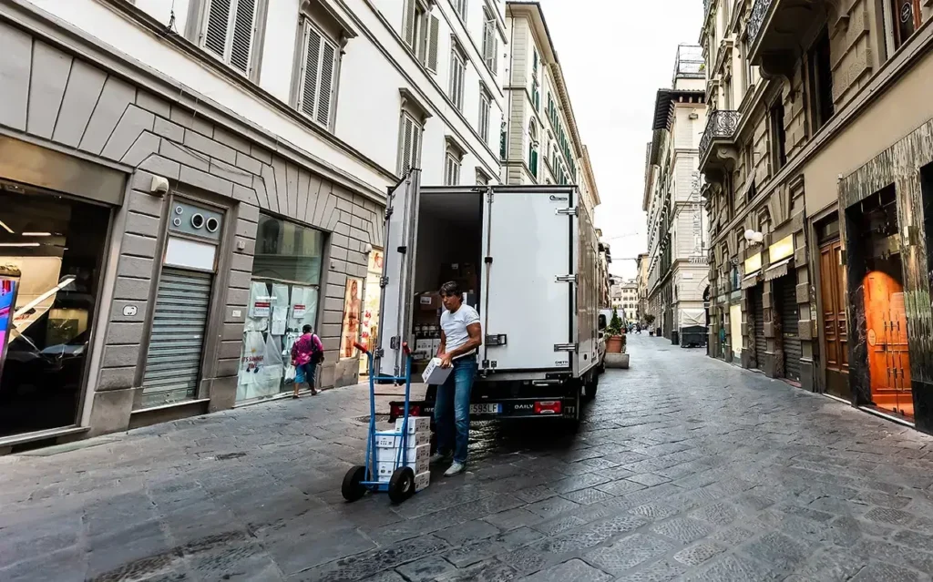
How to prevent delays in Home Delivery with real-time transport insight
Voorkom vertraging in Home Delivery met realtime inzicht, slimme ritbegeleiding en voorspellende verkeersinformatie. Simacan helpt chauffeurs sneller leveren en informeert klanten automatisch bij uitloop of routeproblemen.
Challenges and opportunities for urban foodservice logistics
Urban foodservice logistics face challenges like congestion, lack of collaboration, and electrification. How real-time transport visibility can unlock efficiency and sustainable delivery.
Gaining control over urban logistics costs
Control urban logistics costs with real-time insights: Urban logistics is complex and costly, especially with EVs, emission zones, and rising fuel prices. Simacan’s platform provides real-time visibility, cost analysis, and scenario modeling to reveal the true impact of every trip. This enables smarter planning, better customer communication, and data-driven decisions that reduce costs and improve service.
Orchestration in logistics: connecting what exists, steering what matters

Discover how transport orchestration enhances real-time logistics control by connecting systems, breaking down silos, and enabling smarter decisions. Learn how a logistics Control Tower adds predictive insights, cross-chain collaboration, and EV integration to your existing transport setup, without replacing it.
Simacan & Aventeon deliver the best experience!
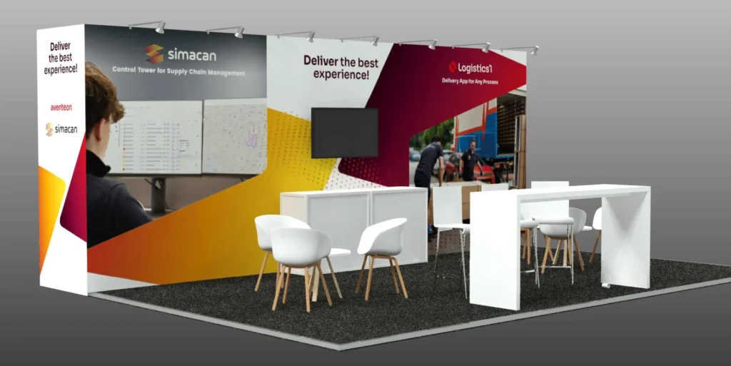
Simacan & Aventeon deliver a seamless, real-time logistics experience, linking control tower insights with smart driver execution for optimal delivery performance.
Picnic deploys Simacan to streamline middle mile logistics
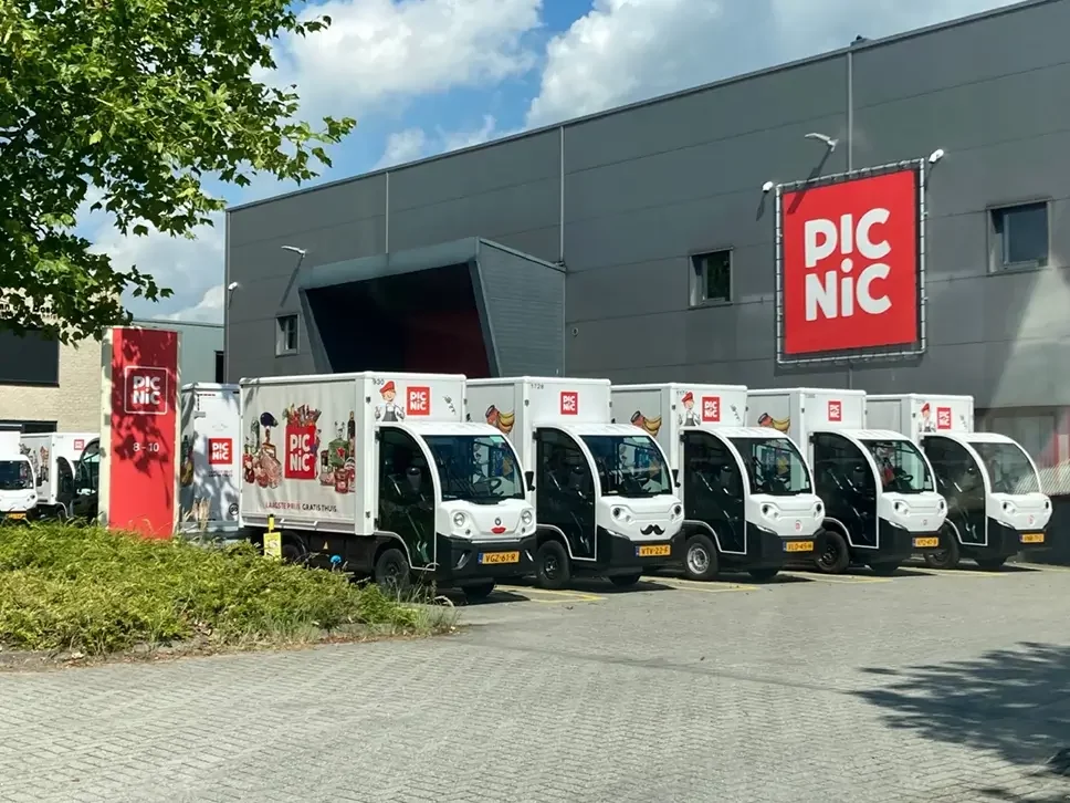
Picnic is enhancing its middle mile logistics by implementing Simacan’s control tower platform, enabling real-time visibility and streamlined coordination with external carriers. This strategic move supports Picnic’s goal of scalable, tech-driven logistics while ensuring delivery reliability and operational efficiency.
Can you calculate the real-time location of spot carriers using a Digital Twin?

Simacan’s digital twin transforms logistics by optimising location data, enhancing ETA accuracy, and boosting operational efficiency. Unlock real-time insights, predictive analytics, and seamless collaboration to elevate your supply chain.
Route book: Trip information for drivers
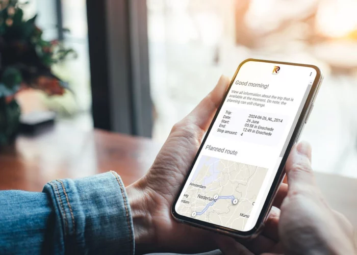
The Simacan Route Book provides truck drivers with essential, real-time route information via a mobile browser. It ensures optimal preparation, enhances safety, and supports sustainable transport by including preferred first and last-mile routes. Ideal for improving efficiency and aiding less familiar drivers, it keeps planning updates seamlessly integrated.